The wall commonly known as ‘Hadrians’ is probably the best known and certainly the largest Roman artifact in the UK. The fortification wasn’t known as ‘ Hadrian’s’ in his time, his family name was Aelius, so it was most probably called The Aelian Wall.
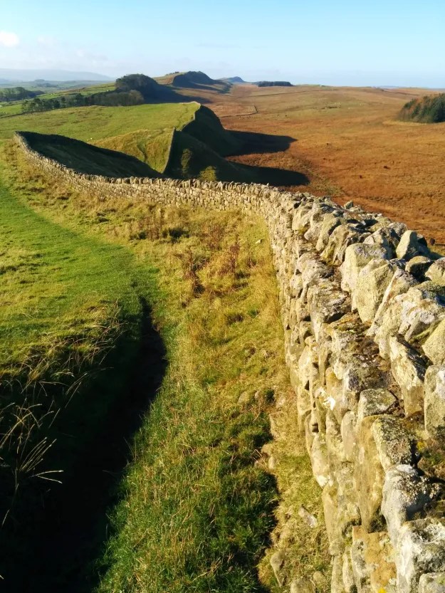
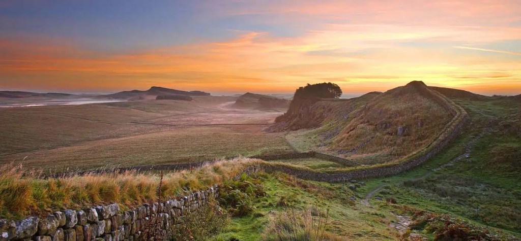
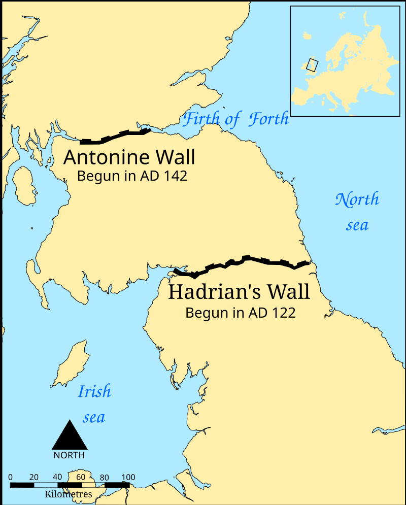
The wall was built not only to defend the northernmost limit of the Roman Empire, but also as a ‘demarcation zone’, a border control point, where people and goods coming into and out of the Empire could be monitored and taxed. It stood as the most northerly frontier of the Roman Empire for over 300 years and runs for approximately 74 miles (118 kilometers) between Bowness-on-Solway in the west and Wallsend in the east, and measured about 10 feet (3 meters) wide and almost 15 feet tall.
The western portion of the wall was made of turf and ran for 29 miles. Its width was about 20 feet. There are historians who think that the northern facing elevation of the stone wall would have been whitewashed to provide a startling visual statement that the Romans were here, and here to stay.
It took a workforce of almost 15,000 men units of all three of Britain’s legions to construct the Wall: the II Augusta based in Caerleon in South Wales, the VI Victrix from York and the XX Valeria Victrix from Chester – who were also once based around Wroxeter Roman City.
Hadrian’s Wall was garrisoned by auxiliary soldiers from across the Roman Empire. These were non-citizens who were recruited into the army and often stationed far away from their homeland.
Although most of the soldiers manning Hadrian’s Wall came from northern Europe, units were also posted there from further afield. Some were Asturians (from northern Spain) stationed at Chesters Roman Fort, and Dacians (from Romania) at Birdoswald Roman Fort. Perhaps the furthest from home were the Syrians at Housesteads Roman Fort, who were stationed alongside the Tungrians from Belgium.
The construction started in A.D. 122, after a visit to Britain by Emperor Hadrian, who reigned between A.D. 117 to 138, and rather than continually expand his Empire, was determined to consolidate his borders. The areas known today as England and Wales were both under Roman control by A.D. 61, when first the southern tribes of the Atrebates and Brigantes, the Druids on Angelsey, and then in the east the Iceni under Boudica, were defeated. The land to the north, Scotland, had successfully resisted Roman efforts to take permanent control of the lowlands and there were almost constant skirmishes.
The wall was built using local materials by Roman soldiers from the II, VI and XX legions, and the initial fortifications were finished quite quickly and were manned by auxiliary units who provided the security and aditional strength should the legions need it.
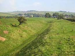
To the north of Hadrian’s Wall was a V-shaped ditch, and to the south was another line of defense called the “vallum,” which was constructed gradually. The vallum consisted of a ditch flanked by large earth ramparts which had wooden spikes embedded in the bottom of it.
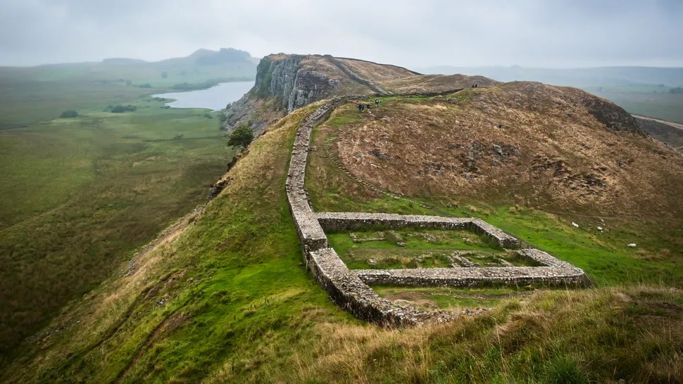
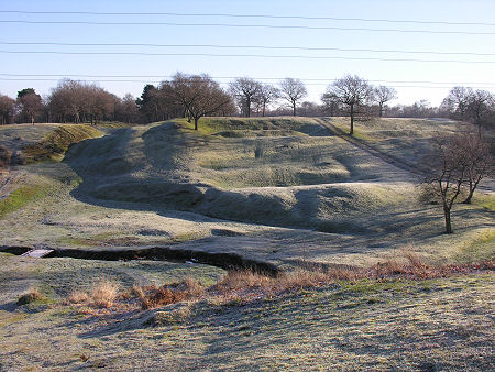
A milecastle, a small gateway that could house a few soldiers, was positioned about every mile of the wall. There were two turrets between each milecastle. In addition, large fortresses were built about every 7 miles (11 km) apart and were up to 9 acres (3.6 hectares) in size.
Important buildings such as the principia (headquarters building), praetorium (commanding officer’s house), and horrea (granaries) were found in the central range, with the barrack accommodation and other structures at the sides and rear.
Hadrian was noted for his interest in architecture and he is likely to have helped with the planning and design of the wall after he visited Britain in AD 122, after a conflict with both the Britons and the Northern Tribes, as it is known that during this period construction of the Wall started.
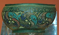
An interesting find, far away from the Wall itself in the parish of Ilam, Staffordshire, is the 2nd-century AD enamelled bronze trulla with an inscription naming four of the forts of Hadrian’s Wall. Its decoration uses coloured enamel, a speciality of Celtic art and it is possibly, in addition to its functional role as a cooking or serving vessel, a souvenir of the Wall, made for a soldier who had served there.
The inscription round the rim is engraved and then filled with enamel. It names forts on the wall: MAIS (Bowness-on-Solway), COGGABATA (Drumburgh), VXELODVNVM (Stanwix), CAMMOGLANNA (Castlesteads). The final part, RIGORE VALI AELI DRACONIS, is more elusive in meaning, but refers to the wall VALI, and probably a soldier DRACO. AELI may be part of his name, but was also Hadrian’s family name, so may go with VALI, indicating that the Romans did call the fortification the “Aelian Wall”.
After Hadrian’s death in A.D. 138, his successor Antoninus Pius (reign A.D. 138 to 161) adopted a radically different policy in Britain. He abandoned Hadrian’s Wall and made a concerted effort to conquer the Scottish lowlands. After having some success, he built a new line of fortifications in Scotland known as Antonine’s Wall between what are now the Firths of Forth and Clyde.
Antoninus’ conquest proved only temporary and, by the end of his reign, the Scottish fortifications were abandoned and the original Wall was reoccupied. A series of modifications were then made including the replacement of the turf portion in favour of stone and the construction of a road called the “military way” to the south of the wall. In addition the turrets appear to have been decommissioned and the gateways of the milecastles narrowed.
In the fourth century, as the Roman Empire came under greater military pressure, the gates of the milecastles were narrowed further and some were blocked off altogether.
After the collapse of the Roman Empire in the fifth century and the beginning of the Dark Ages, the political landscape of Britain changed, and the wall became redundant. Its fortifications were quarried for stone, and some of them were used to help build England’s medieval castles, which served as the country’s new premier fortifications.
Hadrian’s Wall is one part of a much larger Roman frontier. At its longest, in the 2nd century AD, the frontier of the Roman Empire stretched for over 5,000km.
The frontier is still a visible feature across large parts of Europe, the Middle East and North Africa. Today its remains can still be seen in the UK, the Netherlands, Belgium, Germany, Switzerland, Austria, Slovakia, Hungary, Slovenia, Croatia, Serbia, Bulgaria, Turkey, Syria, Jordan, Israel, Iraq, Egypt, Libya, Algeria, Tunisia and Morocco.
In the UK, the Hadrian’s Wall Path National Trail connects Bowness-on-Solway in the west with Wallsend in the east. Hadrian’s Cycleway goes even further: it explores the wider Hadrian’s Wall World Heritage Site. Signposted as NC72 between Ravenglass and Arbeia in South Shields, it incorporates the forts, milecastles and turrets along the Cumbrian coast beyond the western end of the curtain Wall.
The Wall is part of the Frontiers of the Roman Empire UNESCO World Heritage Site; in gaining this status, the landmark was officially acknowledged as a site of ‘outstanding value to humanity’ that will be protected and preserved for future generations to enjoy.
Source – English Heritage

Leave a comment